As I started working on the city again I knew that I would have to start getting a sense of scale beyond "really big." Being the center piece, I started with the citadel.
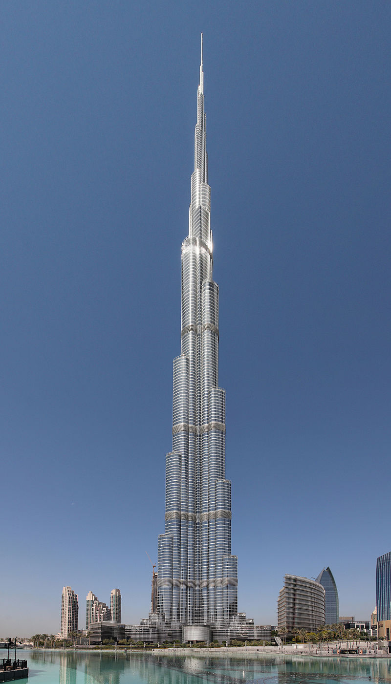
Drawing inspiration from the Burj Khalifa:
And a bit from one of my favorite Disney movies, Fantasia:

It's a quick moment from the first piece of the film but it's stuck with me for a long time. The animation taking place along the later part of Bach's "Tocatta and Fugue in D minor."
Mind you this is the only concept I've made for it, it is likely to change. The smaller buildings surrounding it will be reduced to three honoring the three gods.

~~~~~~~~~~~~~~~~~~~~~~~~~~~~~~~~~~~~~~~~~~~~~~~~~~~~~~~~~~~
Once I settled on the scale of the citadel I could move on to the city planning. After doing some research of street sizes I was able to create a scale that I could use in Photoshop, which came out to be 1 pixel = 2 feet. This way I could make an accurate representation of street width and block size.
I also wanted to make sure I took into consideration traffic flow. Coming from the experience of driving around Boston, I tried my best to avoid that nightmare. Aside from a few areas I was able to keep traffic direction very simple. Street layout and traffic direction are very much like Manhattan.
To quote the hilarious John Mulaney, "It’s a grid system, mother fucka’! Where you at? 24th and 5th? Where you wanna go? 35th and 6th? 11 up and 1 over you simple bitch!"
This is what I came up with:
Arm:
- Dark center strip = highway -

Center:
- Gray circles = citadel buildings, blue = moat (tentative), green = garden/park -

Everything together:

~~~~~~~~~~~~~~~~~~~~~~~~~~~~~~~~~~~~~~~~~~~~~~~~~~~~~~~~~~~
Now to my favorite part. While planing the street layout was fun, I wasn't expecting highway interchanges to even better. So much so that, if it isn't already thing, I'd be up for create a trainspotting sub culture, where instead of traveling to see different trains, we'd travel to experience different interchanges. Dorky I know, but there are some really cool ones out there.
As stated before the dark gray lines in the center of each arm are multi-lane highways that converge at the center, providing easy and quick access to each part of the city.
The complete highway system:

Placed in the city:

To get from arm to arm using the three way interchange in the center would be best. To get to other parts of the center area, taking one of the four way interchanges onto the rotary using off ramps to get back into the city.
~~~~~~~~~~~~~~~~~~~~~~~~~~~~~~~~~~~~~~~~~~~~~~~~~~~~~~~~~~~
Designing the interchanges was fun and challenging, my favorite kind.
I started with the four way. The traditional (and boring) design:

But that's pretty lame and requires a lot of space.
Now this?
Fucking cool. Resembling a Celtic symbol? Even cooler. Time to build in Maya!
I start with a single curve, then using a function called "duplicate special" I am able to create three more identical curves. What makes this duplication "special" is that using this method I can edit one curve and the duplicate curves repeat the edits on them selves in real time. In short, what I do to one thing is done to the others.

From there I can tweak the curves to make sure they are just right. I'm not kidding, this takes an embarrassingly long amount of time. When it comes to curves or poly-flow, shit has to be perfect. Will the viewer notice? Probably not. But I will!
Once the curves are perfect, I extrude some 3D geometry along them.
Tweak the heights and you get this:

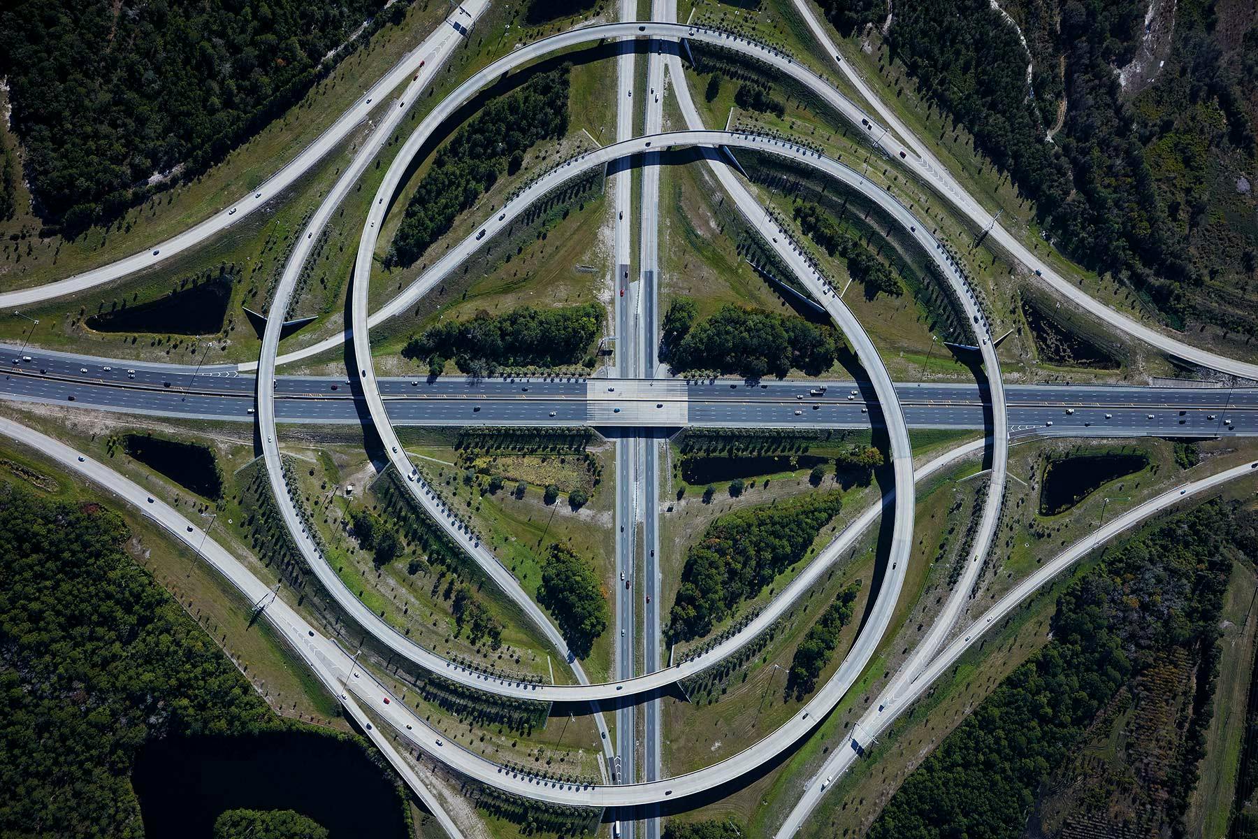
The three way interchange was a little more tricky. You don't really find three highways coming together like this so finding a real world example proved difficult. What I did find was some builds from various city building simulation games (Sim City or Cities: Skylines), albeit shitty and low resolution.

This is what I came up with:

Pretty good right? Curves were nice. A cool design. Ok, good to go. Moving on.
Wait a minute... What's this?

A triangle? Everyone loves a good equilateral triangle, am I right or am I right? Shit, it's not straight. Must. Have. Perfection.
Should it point up?

Or down?

Well if you point it down, there's be a more interesting dynamic between the two shapes shown below.

Down it is. Twisting to get the triangle pointing down contorted the old roads so now I had to start over.
New curves:

New geometry:

Done! Here's a breakdown of traffic flow. Hopefully the color coding reduces the confusion and allows you to see where ramps go with looking like a tangled knot.
It's a huge image, click it so you can see the details!

There you have it. I'm very please with them and it was a lot of fun to make. Oh, did I mention you won't actually see these interchanges? Yeah, they're all beneath the city as tunnels, so, that's kind of sad. It'll look cool on maps though. Plus I'll know and that's what matters most. :)
No comments:
Post a Comment